
NEWS
Map Ganges River: Geography, Basin, Tributaries, and Major Cities

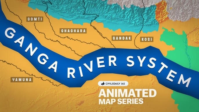
One River That Feeds Over 400 Million People
The map Ganges River is one of the most important rivers on Earth. It provides water to more than 400 million people every single day. That number is larger than the entire population of the United States. When you look at a map of the Ganges River, you start to see just how massive and powerful this waterway really is.
The Ganges stretches about 1,569 miles, or 2,525 kilometers, across northern India and Bangladesh. It starts high in the Himalayan mountains and ends in the Bay of Bengal. Along the way, it passes through some of the most densely populated land on the planet. Understanding its geography, basin, tributaries, and major cities gives you a clear picture of why this river matters so much.
This article walks you through everything you need to know about the Ganges River map. You will learn where the river starts, how wide its basin is, which rivers feed into it, and which big cities sit along its banks. Whether you are a student, a traveler, or just someone curious about the world, this guide gives you useful and clear information.
Where Does the Ganges River Start? The Source and Origin
The Ganges River begins at a glacier called Gangotri Glacier in the state of Uttarakhand, India. The exact starting point is a cave called Gaumukh, which means “cow’s mouth” in Hindi. This spot sits at an elevation of about 12,769 feet, or 3,892 meters, above sea level. The water that drips and flows from this glacier becomes the mighty Ganges.
At its source, the river is called the Bhagirathi River. It flows southwest through deep gorges in the Himalayas before it meets another river called the Alaknanda at a town called Devprayag. After this meeting point, the combined river is officially called the Ganges, or Ganga in Hindi. This is a sacred spot for Hindus and draws thousands of pilgrims every year.
The upper section of the river is fast and rough. The water rushes through steep mountain valleys before it reaches the plains of northern India. Once it leaves the mountains, the river slows down and spreads out across flat land. This change in speed and shape plays a big role in how the river behaves throughout its entire length.
The Full Path of the Ganges: How the River Flows Across the Map
Once the Ganges leaves the hills near Haridwar, it enters the Indo Gangetic Plain. This is one of the largest flat stretches of land in all of Asia. The river begins to wind and curve as it moves eastward through states like Uttar Pradesh, Bihar, and West Bengal in India. It finally crosses into Bangladesh before emptying into the Bay of Bengal.
The river does not flow in a perfectly straight line. It twists and turns across the plain, creating large bends called meanders. These bends shift over time as the river erodes soil on one side and deposits it on the other. This process has been happening for thousands of years, slowly reshaping the landscape.
In Bangladesh, the Ganges joins with the Brahmaputra River. Together, they form the Padma River. The Padma then merges with the Meghna River and creates a massive delta called the Sundarbans Delta, also known as the Ganges Delta. This delta is the largest river delta in the world, covering about 41,000 square miles, or 105,000 square kilometers.
The delta region is filled with channels, swamps, and mangrove forests. It is home to wildlife like the Bengal tiger and the Irrawaddy dolphin. Many millions of people also live in this low lying area, even though it is frequently at risk from flooding and storms.
The Ganges River Basin: How Much Land Does It Cover?
The Ganges River basin is the area of land that drains into the Ganges and its connected rivers. This basin covers about 400,000 square miles, or over 1 million square kilometers. It spreads across parts of India, Nepal, China, and Bangladesh. On any Ganges River map, this basin looks enormous compared to the river itself.
The basin includes some of the most fertile farmland in the world. Farmers grow wheat, rice, sugarcane, and lentils in this region. The rich soil comes from millions of years of sediment deposited by the river and its tributaries. This fertile land is one of the main reasons so many people have lived along the Ganges for thousands of years.
The basin is also home to one of the highest population densities on Earth. Some parts of the Ganges basin have more than 1,000 people per square mile. Cities, towns, and villages line the riverbanks from the mountains all the way to the sea. The river is not just a source of water but also a source of food, transportation, and culture for everyone who lives near it.
Rainfall in the basin varies by season. The monsoon season, which runs from June to September, brings heavy rain that floods the river and its tributaries. During the dry season, from October to May, river levels drop significantly. This seasonal pattern affects farming, drinking water supply, and daily life for hundreds of millions of people.
Major Tributaries of the Ganges: Rivers That Feed the Giant
The Ganges does not get all its water from the Gangotri Glacier alone. Dozens of rivers, called tributaries, flow into the Ganges along its long path. Some of these tributaries are major rivers in their own right. Together, they deliver enormous volumes of water and sediment into the main river.
The most important tributary is the Yamuna River. The Yamuna starts in the Yamunotri Glacier in Uttarakhand and flows parallel to the Ganges for a long stretch before joining it at Prayagraj, a city formerly known as Allahabad. The confluence, or meeting point, of the Yamuna and Ganges is one of the holiest sites in Hinduism. The Kumbh Mela, the world’s largest human gathering, takes place there every few years.
Other major tributaries include the Ghaghra River, the Gandak River, and the Kosi River, all of which flow down from Nepal. These rivers carry meltwater from the Himalayas and are responsible for significant flooding during the monsoon season. The Son River joins the Ganges from the south, draining parts of central India.
Here is a quick look at some key Ganges tributaries:
| Tributary | Origin | Joins Ganges At |
|---|---|---|
| Yamuna | Yamunotri Glacier, Uttarakhand | Prayagraj, Uttar Pradesh |
| Ghaghra | Tibet/Nepal Himalayas | Saran District, Bihar |
| Gandak | Nepal Himalayas | Hajipur, Bihar |
| Kosi | Nepal Himalayas | Kursela, Bihar |
| Son | Maikal Hills, Madhya Pradesh | Patna, Bihar |
| Ramganga | Kumaon Hills, Uttarakhand | Kannauj, Uttar Pradesh |
Each tributary adds its own character to the main river. Some carry clean mountain water, while others carry heavy loads of silt and clay. The Kosi River, sometimes called the “Sorrow of Bihar,” is known for flooding and changing its course. Its behavior has affected millions of people over hundreds of years.
Major Cities Along the Ganges River: Life on the Banks
The Ganges River map is dotted with dozens of cities that have grown up along its banks. These cities represent some of the oldest and most historically rich places in all of South Asia. From ancient pilgrimage sites to modern industrial centers, the river has shaped urban life in the region for millennia.
Haridwar is one of the first major cities the Ganges reaches after coming down from the mountains. It sits in the state of Uttarakhand and is one of the seven holiest cities in Hinduism. Millions of pilgrims visit Haridwar every year to bathe in the river. The famous Har Ki Pauri ghat, or bathing steps, is one of the most photographed spots along the entire river.
Kanpur is the largest city along the Ganges in terms of industrial activity. Located in Uttar Pradesh, Kanpur is a major center for leather goods, textiles, and chemicals. The city has also become known for contributing to river pollution, as industrial waste and sewage have been a serious problem for decades. Government and environmental groups have been working to clean up this stretch of the river.
Prayagraj, formerly known as Allahabad, sits at the famous confluence of the Ganges and Yamuna rivers. This city is deeply tied to Indian history. It was a major center of the Indian independence movement. It is also the site of the Kumbh Mela, which draws hundreds of millions of visitors over its duration. Prayagraj is an important educational and cultural hub in northern India.
Varanasi, also known as Benares or Kashi, is perhaps the most famous city on the Ganges. It is one of the oldest continuously inhabited cities in the entire world, with a history stretching back at least 3,000 years. Hinduism teaches that dying in Varanasi brings moksha, which means freedom from the cycle of rebirth. The city’s ghats are lined with temples, cremation sites, and thousands of pilgrims every single day.
Patna is the capital of Bihar state and one of the largest cities along the river. It was once the ancient capital of the Maurya Empire, one of the greatest empires in Indian history. Today, Patna is a major administrative and commercial center. The Ganges is very wide here, often stretching more than 3 miles across during the monsoon season.
Kolkata, formerly known as Calcutta, sits near the mouth of the Ganges in West Bengal. It was the capital of British India and remains one of the largest cities in South Asia today. Kolkata sits on the Hooghly River, which is actually a distributary, or branch, of the Ganges. The city is a major port and cultural capital with a rich history of literature, art, and politics.
Dhaka, the capital of Bangladesh, does not sit directly on the Ganges but is part of the broader Ganges delta system. The Buriganga River, a distributary of the Padma, flows through the city. As the Ganges nears the sea in Bangladesh, it splits into dozens of channels that feed into the delta, and many millions of people live among these waterways.
The Ganges Delta: Where the River Meets the Sea
The Ganges Delta is the final destination of all the water that flows through this massive river system. It is located where the Ganges and Brahmaputra rivers merge and spill out into the Bay of Bengal. This delta region covers parts of both West Bengal in India and almost all of Bangladesh. It is one of the most ecologically and humanly important places on Earth.
The delta is famous for the Sundarbans, a vast mangrove forest that covers about 3,860 square miles. The Sundarbans is a UNESCO World Heritage Site and is home to the largest population of Bengal tigers in the world. It also serves as a natural barrier against cyclones and storm surges that regularly hit the Bay of Bengal coast.
Many towns and villages in the delta are built on islands formed by river sediment. These islands shift and change shape over time as the river deposits new material. Life in the delta is tied closely to the river, with fishing, farming, and boat travel being central parts of daily routines. However, rising sea levels and stronger storms are making life harder for the people who live there.
Flooding is a constant reality in the delta. During the monsoon season, huge amounts of water rush down the rivers from the Himalayas, pushing river levels far above normal. While flooding brings fresh sediment that keeps the soil fertile, it also destroys homes, crops, and lives. Managing this balance is one of the biggest challenges for governments in both India and Bangladesh.
The Ganges River and Its Ecological Importance
The Ganges River is not just important for people. It is also home to hundreds of species of fish, birds, mammals, and plants. The river supports a unique food web that stretches from the mountains all the way to the sea. Several species that live in the Ganges cannot be found anywhere else on Earth.
The Ganges River dolphin, also called the Susu, is one of the most famous animals in the river. It is a freshwater dolphin that is almost completely blind and uses echolocation to find food. This dolphin is an endangered species because of pollution, hunting, and the construction of dams and barrages that block its movement along the river. The Indian government has declared it the National Aquatic Animal of India.
The river also supports the Ganges soft shell turtle, the Indian skimmer bird, and hundreds of fish species. Many of these animals are threatened by declining water quality and reduced water flow. Industrial runoff, untreated sewage, and agricultural chemicals have significantly degraded the health of the river over the past several decades.
The Indian government launched the Namami Gange Programme in 2014. This is a large scale effort to clean the river and restore its ecological health. The program includes building sewage treatment plants, cracking down on industrial pollution, and planting trees along the riverbanks. Progress has been slow, but some improvements have been reported in recent years.
Why the Ganges Is Sacred: Culture, Religion, and History
For over a billion Hindus around the world, the Ganges is not just a river. It is a goddess, a mother, and a purifier. Hindus call the river “Ganga Mata,” which means Mother Ganga. They believe that bathing in its waters washes away sins and that scattering a loved one’s ashes in the river helps the soul reach heaven. These beliefs are thousands of years old and remain deeply held today.
The river has shaped Indian civilization since ancient times. The great cities of the Maurya and Gupta empires, two of the most powerful ancient states in human history, were built along its banks. Trade, agriculture, and culture all flowed along the river for thousands of years. Many of India’s most important texts, poems, and philosophies were written by people who lived in the Ganges basin.
Buddhism also has a deep connection to the Ganges region. The Buddha gave his first sermon near Varanasi at a place called Sarnath. Many of the sites important to Buddhist history are located in the Ganges plain. The river served as a highway for merchants, missionaries, and scholars who spread ideas and religion across the subcontinent.
Even today, the river remains central to daily life for hundreds of millions of people. Morning prayers at the ghats, festivals like Chhath Puja and Diwali, wedding rituals, and funeral rites all involve the Ganges in one way or another. The river is woven into the fabric of South Asian life in ways that go far beyond its physical presence on a map.
Environmental Challenges Facing the Ganges Today
Despite its cultural and historical importance, the Ganges River is in serious trouble. It is one of the most polluted rivers in the world. A combination of rapid population growth, industrialization, and poor waste management has put enormous pressure on the river’s health. The problems are complex, but they are also very real and very urgent.
Every day, billions of liters of untreated sewage flow directly into the river from cities and towns along its banks. Many municipalities simply do not have enough sewage treatment capacity to handle the waste produced by their growing populations. This sewage contains harmful bacteria and pathogens that make the water dangerous to drink or even touch in some sections of the river.
Industrial waste is another major problem. Tanneries in Kanpur, chemical plants in Uttar Pradesh, and factories throughout the basin dump toxic materials into the river or into groundwater that eventually reaches it. Heavy metals like chromium and lead have been found in the river at levels far above safe limits. This pollution harms both human health and wildlife.
Religious practices also contribute to pollution, though at a much smaller scale than industrial and sewage sources. Flower offerings, plastic packaging, and even partially cremated bodies are sometimes left in the river. Many religious leaders and communities are now working to promote cleaner and more environmentally responsible practices. The combination of government action and community involvement is seen as the best path forward.
Dams, Barrages, and Water Use Along the Ganges
The Ganges River has been heavily modified by human engineering over the past century and a half. Dams, barrages, and canals have been built to control flooding, generate electricity, and supply irrigation water to farms. These structures have brought real benefits, but they have also changed the river in ways that are not always positive.
The Farakka Barrage, built in 1975 near the border of India and Bangladesh, is one of the most controversial structures on the river. India built it to divert water into the Hooghly River to keep Kolkata’s port navigable. Bangladesh argues that the barrage reduces water flow into its territory during the dry season, harming farmers and increasing salt intrusion in the delta. The two countries have signed water sharing agreements, but disagreements continue.
The Tehri Dam, built on the Bhilangana tributary near the source of the Ganges in Uttarakhand, is the tallest dam in India. It generates hydroelectric power and supplies drinking water to cities like Delhi, Haridwar, and Rishikesh. However, critics say it has displaced hundreds of thousands of people and disrupted the natural flow of the river in the upper reaches.
Irrigation canals draw off huge volumes of water from the Ganges throughout its length. In some stretches, especially during the dry season, so much water is diverted that the river becomes very shallow or even runs dry in places. This reduced flow concentrates pollution and reduces the river’s ability to clean itself naturally. Managing water demand from agriculture, cities, and industry is one of the greatest challenges for the future of the Ganges.
Climate Change and the Future of the Ganges River
Climate change is already affecting the Ganges River system, and the impacts are expected to grow over the coming decades. The Himalayan glaciers that feed the river are melting faster than they are being replenished by snowfall. Scientists believe that in the short term, this will cause more water in the river. But over the long term, as glaciers shrink, the dry season flow of the river could drop significantly.
Changes in monsoon patterns are also a concern. Some studies suggest that monsoon rains may become more intense but less predictable, leading to worse flooding during wet seasons and more severe droughts during dry ones. This unpredictability makes it harder for farmers to plan their growing seasons and for governments to manage water resources.
Rising sea levels threaten the Ganges Delta. As the ocean rises, saltwater pushes further into the delta’s channels, ruining farmland and contaminating drinking water supplies. Low lying islands in the Sundarbans are already being lost to the sea. Millions of people in Bangladesh and West Bengal could eventually be displaced by these changes.
Despite these challenges, there is hope. Investment in water treatment, cleaner farming practices, reforestation of riverbanks, and international cooperation between India, Nepal, and Bangladesh can all help protect the future of the Ganges. The river has sustained civilization for thousands of years. With the right choices, it can continue to do so for thousands more.
Conclusion: The Ganges River Is a Lifeline Worth Protecting
The Ganges River map tells a story that goes far beyond lines on paper. It shows a river that starts in the icy heights of the Himalayas, crosses one of the most densely populated plains on Earth, and ends in the world’s largest river delta. It feeds over 400 million people, supports extraordinary biodiversity, and holds deep spiritual meaning for over a billion people worldwide.
Its tributaries, from the sacred Yamuna to the powerful Kosi, add volume and character to the river at every stage of its long path. Its major cities, from Haridwar to Kolkata, carry thousands of years of history in their streets and ghats. The Ganges is not just a geographic feature. It is the heartbeat of an entire civilization.
But the river faces real and serious threats. Pollution, overuse, climate change, and poor management have put it under enormous stress. The good news is that people are paying attention. Governments, scientists, communities, and religious leaders are all working together to reverse the damage and secure the river’s future.
If you want to learn more about the Ganges River, explore geographic maps, visit academic resources from organizations like the National Geographic Society or the World Wildlife Fund, or look into the Indian government’s Namami Gange Programme. The more people know about this river, the better the chances are that it will be protected for future generations. Start exploring the map today and discover one of the most remarkable rivers in the world.
The Hear UP is a leading technology publication house. Our origin dates back to 2016 as a small forum for technology enthusiasts. Since then, The Hear UP has transformed into a trusted source for emerging tech and science news.
The majority of our news is provided by staff writers. Other news is provided by news agencies and freelancers.
All of our contributors are members of the Society of Professional Journalists.
If you need to contact a news editor from The Hear UP you can find a list of email addresses on our contact page.
Our Organisation
The Hear UP